

Torres del Paine are a group of mountains that are located in the Southern Patagonia of Chile, specifically within the Torres del Paine National Park.
Located 150 kilometers from the city of Puerto Natales (gateway to the National Park) and 400 kilometers north of Punta Arenas, this National Park is one of the favorite destinations for tourists traveling to the Patagonia. In 2013 was named the Eighth Wonder of the World and chosen as the fifth most beautiful place on the planet.
The National Park is worldwide known for the massifs that give it its name, granite giants shaped by the force of glacial ice. Another of its attractions is the Cueva del Milodon Natural Monument, home to an ancient prehistoric, herbivorous mammal, with a size that exceeded 3 meters in height.
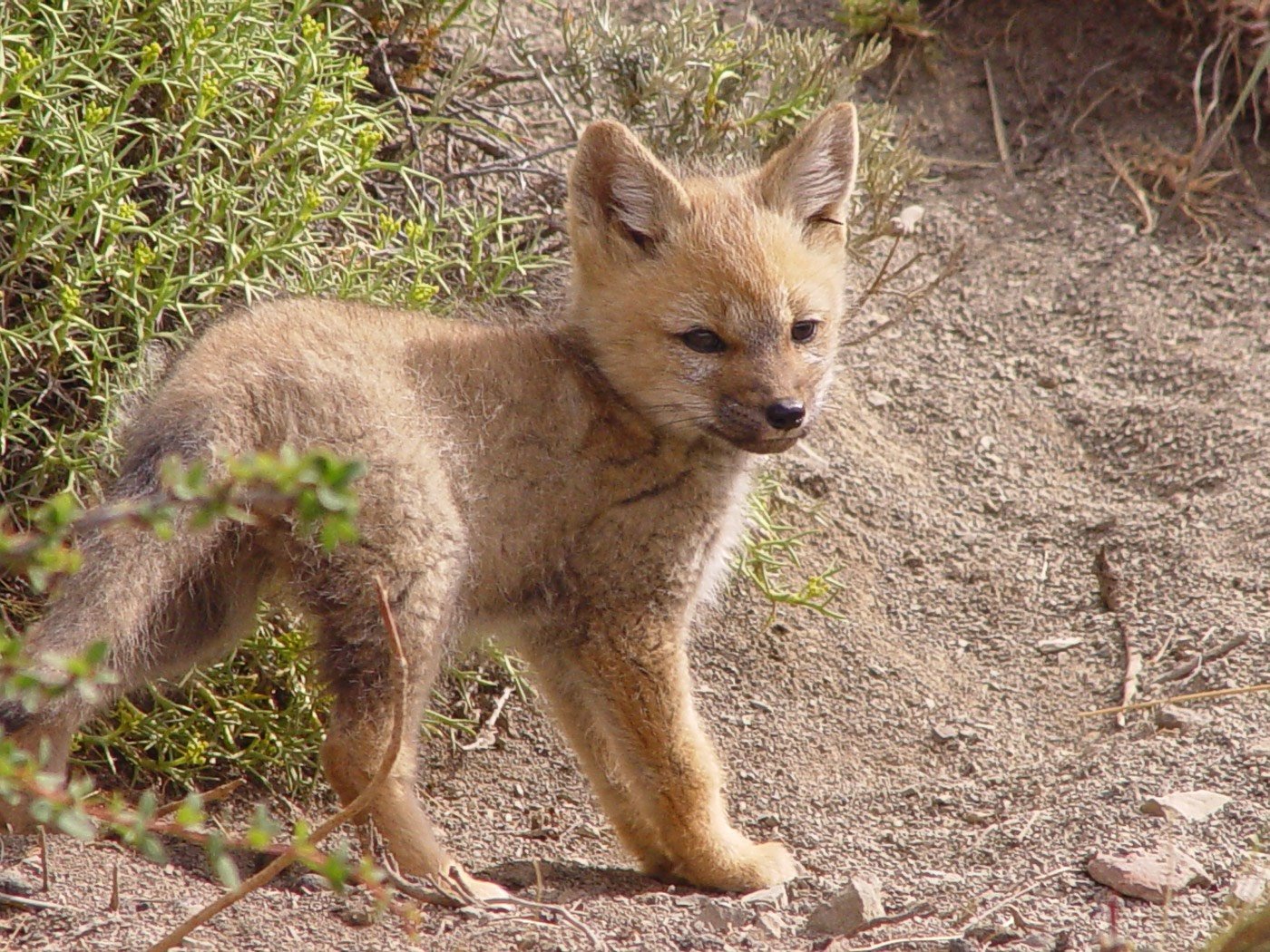
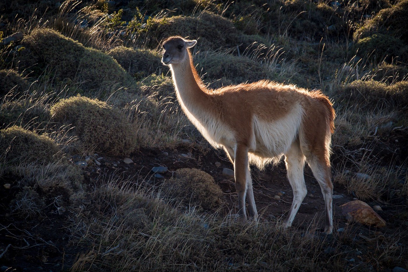
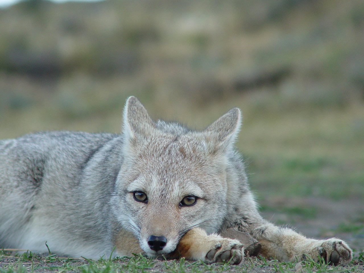
The unit stands out for the protection of fauna species such as rhea, tile, and owl. As for mammals, some of the 25 species present in the park are the puma, chingue, red fox, as well as different kinds of reptiles, amphibians and fish.
HOW TO GET THERE
By air: Between Santiago and Punta Arenas the flight lasts around 3 hours. From Puerto Montt to Punta Arenas is approximately 2 hours. Once you arrive at the Punta Arenas Airport “Carlos Ibañez del Campo”, you can go directly to Puerto Natales (247 kms.) Or do it from the city of Punta Arenas (254 kms) with an approximate duration of 3 hours. From Puerto Natales there are 100 kilometers to the park, depending on the chosen route. Occasionally there are flights between Santiago and Puerto Natales.
Land route: The distance from Santiago is around 3,115 kilometers (as it must pass through Argentine territory). Between Santiago and Puerto Montt there are 1,024 kilometers; From there you can take a bus that crosses into Argentina through the Puyehue Pass on a route that takes just over a day to reach Puerto Natales and / or Punta Arenas, depending on the route you decide to enter Chile.
By sea or by lake: It can also be accessed by sea (the journey from Puerto Montt to Puerto Natales lasts almost three days) or by lake, navigating through the Ultima Esperanza ford to the Serrano and Balmaceda glaciers, and then going up the river Serrano and get to the park.
WHat to visit
ROUTE BY VEHICLE
A very common way to get to know the park is to travel it through its 100 km of vehicular roads. The park can be explored by vehicle, accessing its various attractions. Some of them are:
– Gray Lake and Glacier
18 km from the Administrative Headquarters is the Gray Nursery, from which it is possible to start a walk that crosses the bridge over the Pingo River and continues to the shore of the lake, where you can appreciate the ice floes. It is also possible from there to navigate the lake and enjoy the view in front of the glacier.
– Salto Grande
It is located in the Pehoé sector, just 2 km from the main route. From the parking lot you have to travel 5 minutes to the viewpoint. If you wish to access the Los Cuernos Viewpoint, continue along the signposted path. From that point, a journey of approx. an hour on the shores of Lake Nordenskjöld and leading to one of the best panoramic views of the Massif Paine.
– Paine River Waterfall
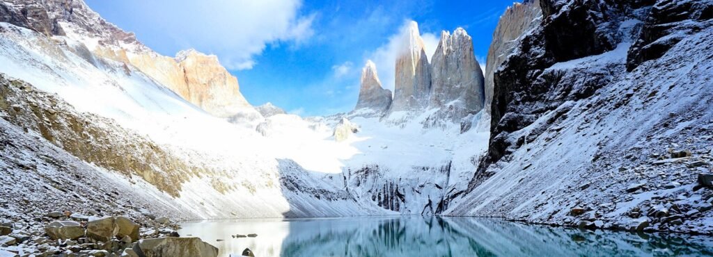
It is located on the Paine River, Laguna Amarga sector, on the road that leads to Laguna Azul. From this point you can see the Torres del Paine (De Agostini, south; Central and Monzino, north), the three granite spiers that gave the park its name.
– Lake Pehoé
The shore of this lake is one of the best places to observe the Cuernos del Paine, as the attractiveness of the mountain range is compounded by the turquoise color of its waters.
– Blue Lagoon
From the neighboring sector to the Laguna Azul Nursery it is possible to get the best view of Torres del Paine without having to trek. This area has an attractive microclimate, reaching temperatures of up to 25ºC in summer.
VIEWPOINTS AND TRAILS IN VEHICULAR ACCESS AREAS
There are some short-distance, low-difficulty trails that are accessible from the road. among them the following stand out:
– Mirador Sierra del Toro
It begins 500 m from the Weber bridge, near the Administrative Headquarters. After an hour and a half of walking, you will reach the Sierra del Toro viewpoint, where you get an imposing view of the largest lake in the region, as well as the Paine River and the steppes of the Serrano River basin.
– Mirador Cóndor
Located in the Pehoé camping area, it allows to know the flora and micro fauna that inhabit the foothills of the Sierra del Toro, with a privileged view of the Paine Massif.
– Nature trail miscellaneous wild
Small route located in the Administrative Headquarters, bordering a wetland and a forest of ñirres. It allows an attractive 360 ° view that includes the Paine Massif, the surrounding mountain ranges and hills and the Toro lake.
– Mirador Ferrier
From the parking lot at the Gray nursery, it is also possible to climb the slopes of Cerro Ferrier. The viewpoint is an hour’s walk away and allows a spectacular view of the Paine Massif, the Southern Patagonian Ice Field and a panoramic view of almost all the lakes present in the park.
– Los Cuernos Viewpoint
From the parking lot near Salto Grande, a path of approximately one hour begins and, with little difficulty, leads to a viewpoint that is located on the shores of Lake Nordenskjöld, which allows an imposing view of Los Cuernos due to its proximity. del Paine.
HIKING – MOUNTAIN CIRCUITS (High season October – April. Low season with restrictions)
– Trail O
It is the most extreme and challenging trekking that, with its more than 100 kilometers of route, crowns the experience after around eight to nine days of intense walking. It is essential to have a physical condition according to the requirement, in addition to the necessary mountain equipment for extreme conditions.
– Trail W
The busiest is called “W” and visits the main landmarks of the park. Its 76.1 kilometers are the most recognized route in Chile. It includes spectacular views of the Gray glacier, on the west side of the Paine massif, up to the imposing ascent to the base of the Torres, east of the mountain range. Between these points is the French Valley, a beautiful green corridor surrounded by steep granite walls. Walking this trail will take you between four and five days, depending on the weather conditions and how long you want to stay in each place.

